Monday, July 26, 2010

Back at Pembroke

July 25     A cool clear day takes us from St. Hyacynthe towards Montreal.  Fortunately, on a Sunday morning, even the big city has light enough traffice to quickly sail through towards Ottawa.   A stop at Masson-Angers for a Montreal smoked meat sandwich and coffee also gives us some conversation with another couple on a Suzuki Boulebard - a nice charcoal gray with black highlights.

An attempt to bypass Ottawa leads us to discover the town of Kazabazua, and a direct ride to Pembroke, ON, across 3 bridges to the peaceful town on the Ottawa river.  The owner of the RV storage place is in on Sunday and says we can pick up the truck and trailer first thing Monday morning.

Pembroke on the Ottawa

Even leaving out such interesting things as giant stuffed anacondas stretched across fields (hay tubes) and the idea that one could spend a couple of months touring Gaspe, taking pictures of churchs for a book (like in Bridges of Madison County we could have Churches of the Gaspe) we are a little sad that the motorcycling part is done.   We do a few errands (like changing the oil in the truck and getting keys cut), load up the bikes and head west.   The windows have to be down as it seems strange to be moving along without the wind on your arms and face.  Barry says to remember: 4 wheels and you don't have to lean in the corners.

By the time we get home we'll have 10,000 km on the truck, 8,000 km on each bike and 70 hrs on ferrys.

As we head back to Vancouver, we'd like to thank all our friends who shared our adventure by reading this blog and look forward to seeing you all soon.

Bye for now.

Saturday, July 24, 2010

July 21 After staying in Sackville, NB, it’s a short 60 km drive to Confederation bridge. It’s totally impressive, rising up over the water, jogging left than right and rising to a high point near the north end. (Does anyone know why it jogs?) It is a weird feeling, riding along high over the water as far as you can see with the land just visible at the far end.

Prince Edward Island is very picturesque – quite flat with lots of farms. In fact we followed a truck with the plate BRN2FRM.

Of course there were a few fields of potatoes, all in bloom, but it seems that what PEI farmers like best are lawns. It seems that every farm has a huge lawn between the house and road, and it is neatly cut at least twice a week.


We cruised up to Charlottetown and stopped to pick up a few things, then road to Georgetown, on the far east end of the island. There wasn’t much there, particularly gas, so we rode over to Montague and had lunch in a small pub called: Sir Isaac’s Restaurant and Mr Garth’s Pub. Another short ride took us the PEI National Park which is the beach on the north side. The nicest one we’ve seen so far. We ended the day at a nice motel in Summerside.


July 22     The weather gods frown again, a light rain when we start turns cold and driving. The Confederation Bridge is even more weird in a stormy fog. It just kept getting worse, until we stopped early for the day at Miramichi, NB. Thank heaven for hot showers and warm rooms.

July 23     Another beautiful day. We could even see the graceful double-arch bridge behind the hotel.


Leaving NB at Campbellton, we head along the south coast of the Gaspe peninsula. The land is fairly flat with farms and quaint small towns every 5 to 10 km.

Each has it’s own immaculately cared for church, each a little different. One of the more unusual is at Sainte-Anne-des-Monts.


The famous Perce Rock, and we are there.


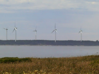
The north side of the Gaspe (St Lawrence) is very similar to the Cabot Trail in NS – mountains with steep. winding roads. Barry says he likes this part even better than the Cabot Trail. The north side must be the windy side as we saw several wind farms, including one with an ‘egg-beater’ style wind generator.


A night at Mont-Saint-Pierre, where we talk to a gentleman who specializes in pictures at sunset and sunrise, when ‘ the light is special’. He says it takes patience and perseverance – like so many things in life.


July 24     Mostly riding, stopping occasionally for pictures, food and gas. Tonight we are near St. Hyacinthe, only about 200 km from Montreal.

Tuesday, July 20, 2010

New Brunswick - Hopewell Cape

July 20   Unloading from the ferry in Saint John, we tour around a little.  With directions from an information specialist on the ferry, we find a Suzuki MC dealer, we steers us to a locksmith who cuts 2 sets of keys for Barry's bike.  Moving down the road, we pass through Fundy National Park, a rolling set of hills covered with a mixed forest carpet leading the the bay.  We stop for lunch at Alma, proclaimed as having the 'highest tides in the world'.

The broad seabed shows how far the water goes down at low tide.  We read that the water flowing into the Bay of Fundy exceeds all the water in all the rivers in the world, twice a day.

The Hopewell Rocks show the effect of the 40 to 50 feet high water washing back and forth.  Some strange shapes result.


Cruising up to Moncton, then over to Sackville, we are set for the night.

Yarmouth, then to Saint John

At Bridgewater, having supper at the River Pub, we talk to a couple of guys on bikes who had just done the Cabot Trail, then followed us down the east? (south? )coast. They are brothers from Niagara Falls and out on their first longer bike trip. We met them again on the Digby ferry and enjoyed talking to them about their trip. They are heading south to Bangor, Maine, then home by way of New York State.

Travelling down the coast we stop for a home-style meal at Cape Wayne. Baked ham with mixed veg. Barry has his new replacement camera and we play around with getting it set up.


We get a picture of stately giants, waving us on our way.

We take a break at Yarmouth, NS – I sit around in shorts and enjoy the sun, while Barry replaces more stuff (like rain gear) and talks to good looking pharmacists. We hit the road at 5:30 am next morning to catch the Digby ferry to Saint John, NB.  Nova Scotia has been unbroken sunshine - what next?

Thieves

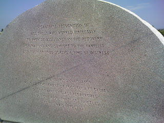
While we are at the Swissair memorial, some low-bred whose  mother barks stole Barry's suitcase.  They obviously saw us go to the site, and grabbed the bags and ran.  Besides clothes, Barry had some back-up credit cards, MC keys and truck keys as well as other papers.  Barry took the event with considerable calm and equanimity.  He filed a police report, and proceded to acquire what he needed to carry on. 

Halifax

July 18 A leisurely ride into Halifax. At Dartmouth, we stopped to get out bearings. There was a seabus coming across, a bridge (toll, 75 cents) and a nice older couple to talk to. The lady was from Cobalt, ON and they met on the internet. They got married and moved to Nova Scotia and loved it (4 years so far). Also, our handsome fellow traveller.
Halifax gets us to another citadel. This one was the British Stronghold and was never taken. It has a Scottish flavor – uniforms include kilts and bagpipes are popping up everywhere. It was impressive the amount the British spent on building to preserve their power in the new world.


A cruise down Quidpool Rd had about 6 blocks of classic cars in a Show n Shine – some beautiful classics. My 79 Granada never looked like that.

It was a relaxed ride to Peggy’s Cove, intending lunch, but a thousand other people seemed to have the same idea, so we’ll look for lunch further down the road.


 We also stop at the nearby memorial for SwissAir Flight 111. It was touching – especially the appreciation for everyone who tried to help.

Sunday, July 18, 2010

Cape Breton Island

July 16   We arrived at North Sydney, CBI at 6:30 in the morning, unloading from the ferry, the Joseph and Claire Smallwood. The ferry was very comfortable and fast, although we spend half of our time sailing along the Newfoundland coast.

Our first stop (after breakfast at Tim Hortons) was at Glace Bay (because it’s there) for fuel, then on the Louisbourg. This was the main French centre to protect the French access to the fisheries and the Gulf of St Lawrence. It was very authentic, with people in costumes both doing and describing how things were in the early 1700’s. We even saw a demonstration on how to load and fire a musket (didn’t get it on video – darn).

After Louisbourg, we headed down to the south end of CBI, the back to Baddeck, in effect circumnavigating Lake Bras D’Or. At Baddeck, we stopped to see the Alexander Graham Bell Museum. He was a powerful character, besides inventing the telephone, he worked on aviation and hydrofoil ships, but his greatest love was working on methods to help the deaf to speak.
I especially liked the exhibit on flying and the Silver Dart, even though I was a year late ;^)

At Baddeck, we had a lobster dinner at the Baddeck Lobster Suppers (next to the Legion ;^) which included all you could each seafood chowder and mussels.

July 17 We are doing the Cabot Trail. Starting from Baddeck, we head out counter-clock wise. We see a lot of Gailic even on the official signs like town names, etc. At the start of the Cabot trail, there is a school of “Gailic, and Celtic Studies”. In other places, there was a lot of French.
The trip around the Cabot Trail is beautiful, as advertised. We took our time, even took the diversion to Meat Cove (recommended by a rider on the ferry). It included about 8 km of gravel road, that got increasingly steep, twisted and narrow, until we thought we would start hearing banjo music ;^).
After surviving Meat Cove, we encounter actual mountains – slow, twisty and steep, just how we like them. I think we went right over the top of Mt MacKenzie. Stopped at one look off and talked with some people from North Carolina. They loved the scenery and the relative coolness.

After travelling north to south twice and seeing everything, we should be honorary Capers, at least for a couple of days.

Down the west coast of CBI, across the Canso Causeway and we are on the Nova Scotia mainland. We planned to stay at Antigonish, but a NASCAR race meet meant we moved on to New Glasgow for the night.

St John's - the Johnson Geo Centre

Johnson Geo Centre

http://www.geocentre.ca/


Another place we visited in St John’s was the Johnson Geo Centre, near Signal Hill and Signal Hill Interpretative Center. The display outside has various kind so stone, some rough and some polished. One we really liked was Anorthrite with some Labradorite (blue inclusions) that would look really nice on a counter top.

The Centre is built right into the rock and displays some geologic history and some future possibilities. Newfoundland has some of the oldest rocks on earth, and Labrador has some that are 450 million years old and are of the few that are easily accessible.

They also have a display section on the Titanic with some authentic items and some from the movie. The description is very critical of the White Star Line, the Captain, and JP Morgan, who was trying to buy dominance in the trans-Atlantic steamship business. The text also implied the 2 inquiries (Britain and the US) were white-washes.

Friday, July 16, 2010

Exploring St. John's, NL

July 11    Riding down from St Anthony, we see a lot of lovely scenery interspersed with rain showers. About halfway down, we pass through Gros Morne, which is a large national park, with moderate mountains and a large valley – no pics. Stayed the night in Rocky Harbour, the “best recreational area in Newfoundland”. Got a lovely almost sunset.

July 12   Heading to St John’s. Decided we should see Corner Brook, as we will probably catch the ferry near St John’s. As we head west, the clouds get lower, the rain get’s heavier, the wind blows more until finally, when we reach Corner Brook we can hardly see anything and stay on the road. So – big u-turn, we’ve done Corner Brook and head east to St John’s and sunshine.


 Signal Hill

July 13

At St John’s, our first goal is Signal Hill, where Marconi received the first trans-Atlantic radio signal. He had all sorts of fun trying to get it set up, and then when he is successful, the undersea telegraph cable companies sue to stop his development (can’t put up with competition, I guess).  There is a lot of history of the British and French seizing the port, in spite of cannons guarding the entrance.


We got to know St John’s pretty well, trying to find a motel room for the night. There was a convention o f lawyers in town cluttering up the place ;^)


July 14  Go to downtown to St John’s George Street, recommended by a couple we talked to in Rocky Harbour. It was a street of bars and discos and something called ‘gentlemen’s clubs’. Since we didn’t feel particularly gentlemanly (19 days on the road) we didn’t investigate further ;^)

We did find a statue celebrating St John’s as the cultural capital of Canada.

George street pic

Our next goal was Cape Spear, the most easterly point of Canada. Very nice layout, with a lighthouse etc. According to the chart, it is:

52 Deg 37’ 30” W

47 Deg 31’ 20” N


Barry noted that from the signs (at Signal Hill), we were closer to London, UK, than Vancouver. We talked to 2 couples from Landmark, Manitoba, which is the middle of Canada(96 deg 48’). Barry has also sailed around Triangle Island, of the north end of Vancouver Island, which is the furthest west point. We also saw some whales just off the coast.


We rode south in sunshine to tour around the Avalon Peninsula. A lovely day, till at the end we started looking for a place to stay the night and it started raining. Fortunately, modern technology – GPS, cell phones, occasionally supplemented by paper maps and tourist guides lead to success and we found a room in Placentia, only about 10 km from where the ferry leaves the next afternoon.

In the morning we catch up on our laundry, look around a little and head for the ferry terminal for a 15 hour trip. We’re trying to decide if this is a MC trip or a series of cruises.

Tomorrow we’ll be on Cape Breton Island, Nova Scotia

Wednesday, July 14, 2010

Getting to know NL

One of our first stops in Newfoundland was at L'Anse aux Meadows, where the vikings visited in about 1000 AD.  The picture above is a replica of one of there long houses, build with 10,000 blocks of peat sod, each about 20 Kg (45 lbs).  There were 3 longhouse ruins, indicated 3 ships and there are indications of several voyages.  A guided tour was informative, while indicating how much was speculation, based on a few facts. 

 It was a lovely day in the sunshine.

A few observations of NL:

1. The people are really friendly, several times people went out of their way to be helpful.  We were stopped, looking at a map in the wind and one person stopped and asked if we needed help.  After a couple of attempts to give complicated directions, he said "Come chase me down a few minutes, boys" and led us to the street that took us to our destination.

2. They are really polite drivers, often when catching up with a car, the driver will slow down, pull over as far as they can and signal when it's clear ahead.  On one corner, Barry turned left, but there wasn't time for me to follow before a car approached.  Since there was a car behind me, I pulled over to let her go by.  Both cars stopped to let me turn.

3. In the northern end, there are wide stretches cleared along side the roads.  In many places, people would put up a small fence, and plant a garden in the flat space.

4.  According to Steve, the tour guide, heating oil is very expensive ($700-800 per month), so people can get a permit to cut 8 cords of wood for $30.  They stack it along the road to dry for a year, with their permit number on a white sign.  The police come along and measure the wood, and give a ticket if you've cut too much.

5. The roads are lined for miles with wild flowers, mostly yellow, either buttercups or daisies, also lots of white daisies are very common and clumps of purple spikes.  Lovely. The roads are quite gently curved and a Buell Lightning would love to ride them.

6. The trees vary in height.  On the north end, they are about the height of a person, but very dense (wouldn't want to try to hike through them.  Then as you go south they get taller, reaching above the height of a power pole, until you get about 50 km from the south end of the Avalon Peninsula, where they disappear completely.

7. People in Newfoundland love to fish with rods - practically every place you can pull off the road by a stream, pond or shore, there is someone fishing.

8. People in Newfoundland are very friendly.  Everyone we've met has been friendly, but NL really go out of their way to help, or just to chat.

That's all for today, more about visiting St John's when we next get access to wireless internt.

Saturday, July 10, 2010

Finally, The Rock

Here we are at Blanc Sablon, the end of Quebec and the start of Labrador.  We spent the night at the Northern Lights Inn which is in Labrador so it is official.
In the morning, there was a mad scramble to get a place on the Apollo.  She had a 'small fire'  the night before and needed an inspection (rumor said) before sailing again.  Barry did some razzle-dazzle with the ticket agent about how motorcycles with priority should be the same a reservations and we made the first ferry (3 hours late) instead of the second which would have been later yet.After sailing through the fog, we are now at St Barbe, officially on the Rock.

Tomorrow we're going to St Anthony.  We'll see the L'Anse aux Meadows, which is where the Vikings had there first settlement, 500 years before Columbus.  If the weather is better, we might take a cruise to see icebergs, whales, and, if we're lucky, some puffins.

Tragedy

A lady from New Hampshire was travelling on the boat with her husband.  The sea on our last leg to Blanc Sablon got quite rough and the lady missed a handrail and fell down the stairs.  Barry was there and did CPR while waiting for the crew to respond, but she died.

People we meet on the Sea Cruise

Hiway 138 is called the Road of Whales (Chemin des Balines), and we did actually see some.  One of the other passengers got some pictures and we may be able to share them with you later.
 
We met this lovely couple from Orlando FL.  He is approaching 80 and they've been married more than 50 years.  They have children in TX, CA, MI and NC and travel by car to visit them.  They've also travelled extensively in Europe so we had some interesting conversations about places we had been and things we've seen.  This trip they'd gone to Michigan for a graduation, then to California for a visit.  They are traveling almost the same route we are.
 
We ate with Bill and Kay several times and always had interesting conversations, as well as jokes about how useful 2 motorcycle would be at the last island, and how bicycles has fallen of a white minivan.
 
Joe from Duncan (Vancouver Island) is walking across Canada.  Starting in February, 2009 he walked to Sault Ste Marie, then this year he's walked to Rimouski, then rode the ferry to Blanc Sablon and St Barbe, NL, pulling his rickshaw-like cart.  He also crossed to St Barbe with us.
 
These 3 French-speaking ladies we met on the ferry are from Lyons, France, Switzerland and near Quebec City respectively.  It was really interesting hearing the different accents, and I could actually understand some of the words. (they also spoke enough English we could enjoy talking with them.)
 
Neil from Toronto is bicycling around the Maritime province.  He's also covering most of the same route Barry and I are.  He and Joe are mostly camping, with the occasional treat of a motel (hot showers rate). 

 We liked the idea that all of us were traveling to similar places in various ways and all enjoying ourselves and each others' company, while doing our own thing.


We made about a dozen stops over the 24 hours we travelled with the Nordik Express.  They were all very interesting and scenic and they all looked a lot like this, with some buildings, boats and a wharf thrown in.

Loading at Natashquan

Our ship comes in.  The Nordik Express is really a freighter, with some cabins and a lounge with some seats.  It is a handy little vessel that turns in a small space with bow thrusters.
 
Sebastian is an expert (5 years) and quickly gets the bikes tied down inside a container. 
Up we go - everything is loaded into containers except people.
 
We have a cozy (small) cabin in the basement (A deck) which we share with another man and a women.  We hardly saw them until after we woke up the next day.  The lounge is full of people who also got up at 4:00 in the morning and are sleeping.  Fortunately most of them got off at the second stop, and then we had room to sit and watch the fog.

Road to Natashquan

This was typical of the tundra type terrain we travelled to reach the end of the road (Hwy 138)  at Natashquan.  We kept seeing signs about how dangerous the moose were, but no moose.

Tuesday, July 6, 2010

Sept-Iles - home of our friend Sophie

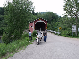
We left Quebec City on Sunday and travelled by way of Saguenay/ Chicoutami through Jacque Cartier National Park.  We stopped at the covered bridge below (bottom) - Why did they build covered bridges? So they could be tourist attactions?  There were lots of bikes on the road, everyone waves.
Monday was a rough day - heavy ice-cold at 90-100 kph  rain seems to drive right through rain gear, boots, luggage.  We were pretty wiped out by the time we got to Sept-Iles.  Tuesday was great - visited Sofie's home, took pictures of the bay, and took an easy run to Havre-Saint-Pierre.  It's our last stop before Natashquan and the ferry.                                                                 

Above - everyone is friendly and surprised we've come from as far as Vancouver.  At Havre-S-P we again  (3rd time)  ran into 2 couples on Cam Ams.  They just got back from Natashquan.

Cheers everyone,
Barry and Ron

More Citadel

This cannon could fire in almost any direction - we like toys that make loud noises.
This building was an observatory, the ball gave a clock signal to the ships on the river.  We know who likes clocks  ;^)


We wandered down into the city, ate and had an ice-cream cone and looked at all the people.

It was a great day at Quebec City - then off to the north-east.